And then I worked out the site layout.
22 March 2021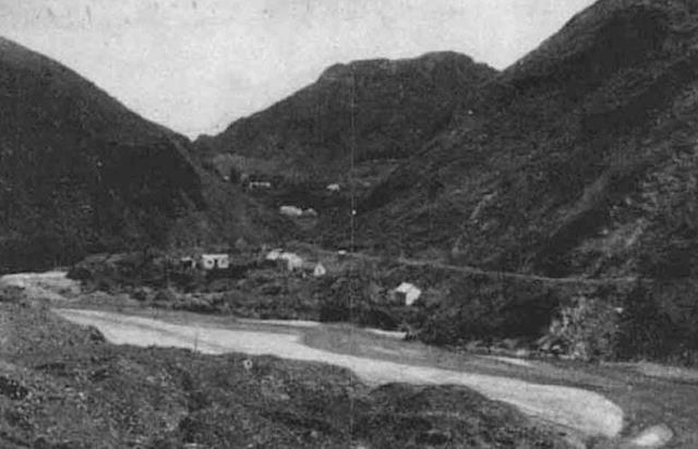
I hadn’t found the settlement at this point. I had Hut 1, parts of a garden wall with an elaborate garden entranceway, or folly, but I still couldn’t figure out where the other huts were.
Finding that last mound of stones by the road which I knew had to be a hut, albeit a small one, was the breakthrough. I went home and poured over the archive photos. Then I saw it. A little hut on the left of a large house/hut that had to have been bulldozed when they created the road. We know 2 of the best huts were destroyed. It’s not big enough to sleep in.....maybe it’s a shed, or the dunny? And then I saw the layout, and knew where other huts were. The next day I was up there with Mike and I showed him. He was as excited as me....! Right alongside Hut 1, in a row...... is Hut 2 and Hut 3...! How did I miss that? We were walking across them all the time, because the ground is very up and down, there is rubble from the road and I just didn’t think the mound slightly to the side was a hut. But the photos proved it. And I could now see the length of the garden wall in the photo.
I found the settlement.